

01 / Overview — Drone survey & geomatics · UK & EU
Survey data
you can build from
Snelgrove Survey Ltd flies photogrammetry and LiDAR missions over live groundworks, residential plots and infrastructure corridors — then returns measured, checked, CAD-ready data. From pre-planning topography to time-stamped progress evidence, every deliverable is traceable back to surveyed control.
Site drawing or postcode is enough to price
02 / Survey specification
Numbers on the drawing, not adjectives
- Absolute accuracy
- ±15 mm
- Ground sample distance
- 8 mm/px
- Survey turnaround
- 72 hrs
- Coverage per sortie
- 60 ha
RTK + checked GCPs
at 60 m AGL
flight to deliverable
single mobilisation
Figures are typical for open-site work; final tolerances are confirmed per project brief.
03 / Deliverables
What lands in your inbox
- Topographic surveyAutoCAD DWG / DXF to your layer standard
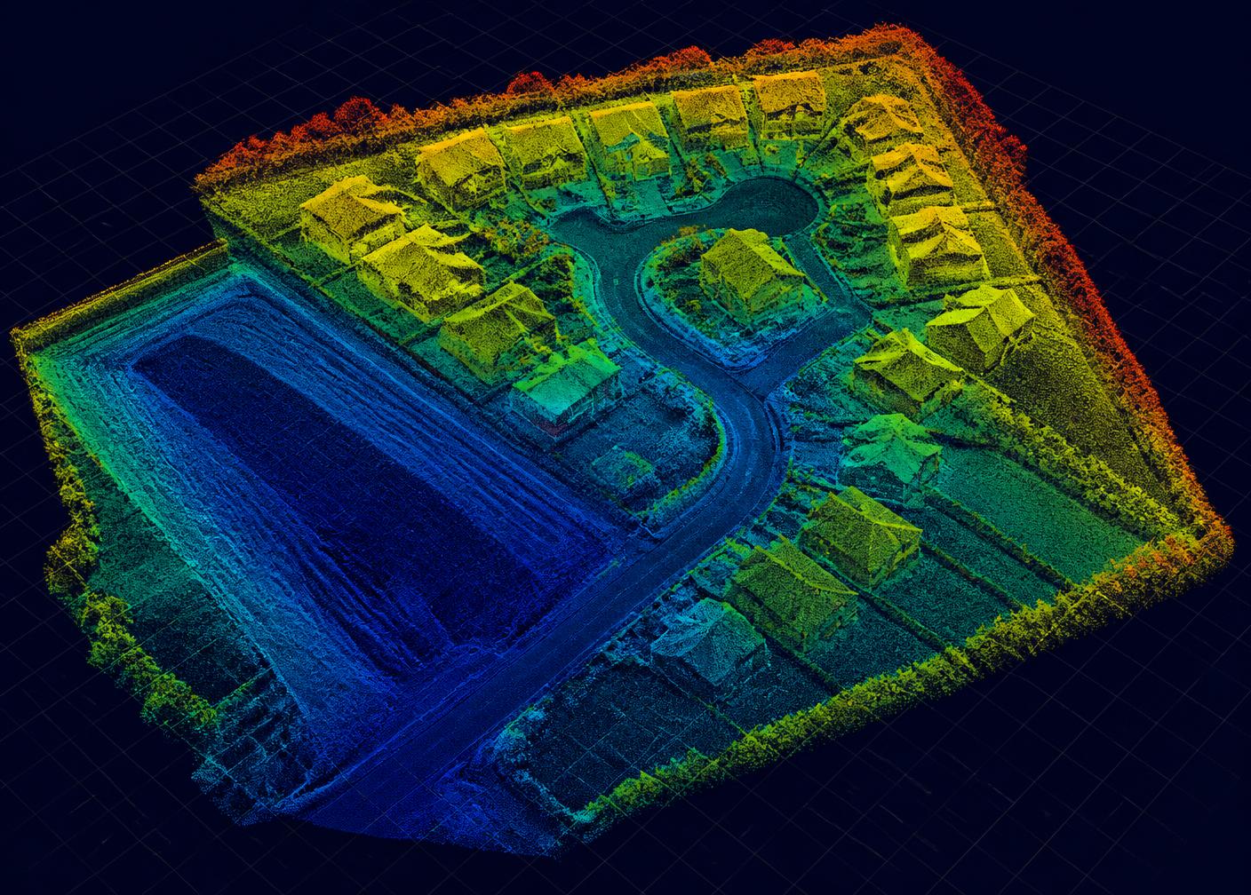
- Point cloudLAS / LAZ, classified ground and features
- Digital terrain modelDTM / DSM raster and contours at set interval
- Volumetric reportCut, fill and stockpile quantities with method note
- OrthomosaicGeo-referenced, time-stamped site plan
04 / Where we fly
Groundworks to residential, plot to portfolio
Construction & groundworks
Pre-start topography, muck-away volumes, weekly progress capture and cost-application evidence.
Energy & utilities
Solar arrays, substations and plant compounds — thermal-ready inspection and as-built comparison.
Civil engineering
Highway and drainage corridors, earthwork balance checks and asset condition monitoring.
05 / Next step
Send us the site. We'll send back a fixed price.
Tell us the location, the area and what the data is for. You'll get a scope, a flight window and a price — usually the same working day.
Request a Quote